Narilatha flower
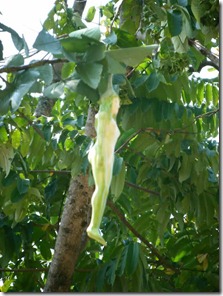
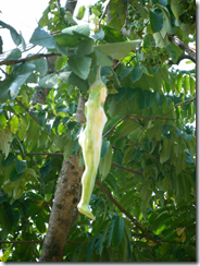
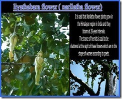
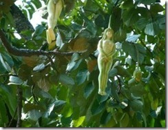
Isn't amazing? It is said that Narilatha flower plants grow in the Himalayan region in India and they bloom at 20-year intervals. The trance of hermits is said to be shattered at the sight of these flowers which are in the shape of women .This flower was in the shape of a naked woman, and said to be as a rare flower.
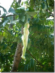
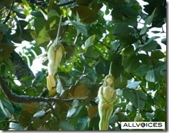
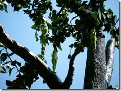
Images for Narilatha Flower
---------------------------------------------------------------------------------------------------------------------------------------------------------------------------------------------------------------------
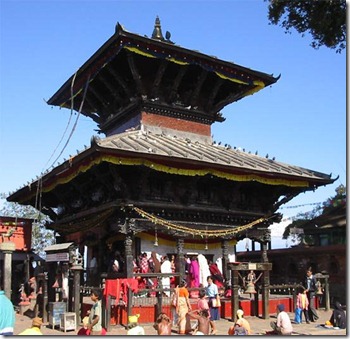 Manakamana is the name of a Hindu Goddess. It is believed that the Goddess fulfils the wishes of the people. The term ‘mana’ means the ‘heart’ or ‘soul’ and ‘kamana’ means the ‘wish’.
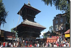
The most popular temple of Manakamana is in Gorkha. The others are in various places like manakamana. It is said that a King of Gorkha was blessed by the goddess to get victory over small kingdoms and make a big Gorkha. Manakamana of gorkha is a popular place for a specific fair called Panchami. The temple was initially inaccessible and one had to ride on horseback for 2–3 days. Now it is easily accessible by Cable Car.
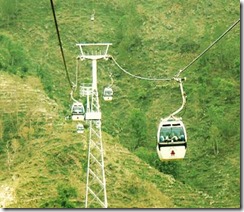
Manakamana is the name of a Hindu Goddess. It is believed that the Goddess fulfils the wishes of the people. The term ‘mana’ means the ‘heart’ or ‘soul’ and ‘kamana’ means the ‘wish’.The most popular temple of Manakamana is in Gorkha.it is 95km from Kathmandu and one can enjoy the true cable car ride at the Himalayan kingdom of Nepal with the beautiful scenic view of mountains and Trishuli river.
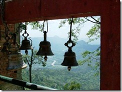
After breakfast our tour guide and vehicle assists you at your hotel and 3 hrs drive to Kurintar and ride a cable car to visit Manakamana temple Lunch at Manakamana with the spectacular view of high snowcapped mountains and sighseeing of the ancient Manakamana temple and back to Kurintar and drive back to Kathmandu.
IMAGE FOR CABLE CAR
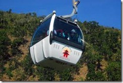
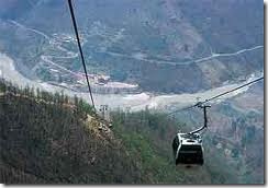
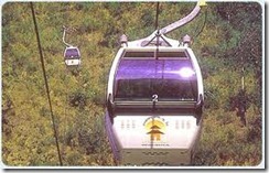
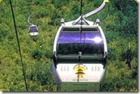
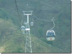
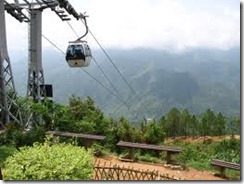
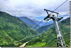
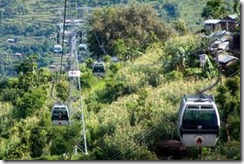
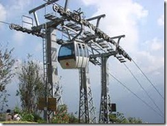
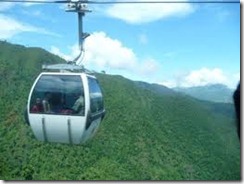
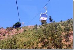
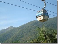
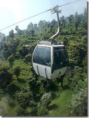
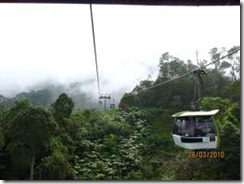
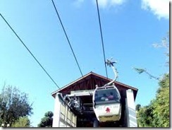
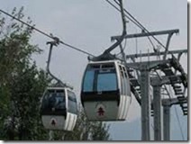
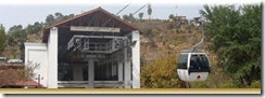
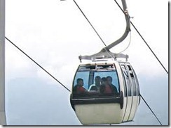
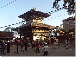
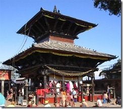
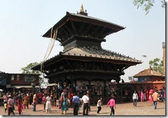
IMAGE FOR MANKAMANA TEMPLE
-----------------------------------------------------------------------------------------------
Chitwan National Park
Chitwan National Park is the first national park in Nepal. Formerly called Royal Chitwan National Park it was established in 1973 and granted the status of a World Heritage Site in 1984. It covers an area of 932 km2 (360 sq mi) and is located in the subtropical Inner Terai lowlands of south-central Nepal in the Chitwan District. In altitude it ranges from about 100 metres (330 ft) in the river valleys to 815 metres (2,674 ft) in the Churia Hills.
In the north and west of the protected area the Narayani-Rapti river system forms a natural boundary to human settlements. Adjacent to the east of Chitwan National Park is Parsa Wildlife Reserve, contiguous in the south is the Indian Tiger Reserve Valmiki National Park. The coherent protected area of 2,075 km2 (801 sq mi) represents the Tiger Conservation Unit (TCU) Chitwan-Parsa-Valmiki, which covers a 3,549 km2 (1,370 sq mi) huge block of alluvial grasslands and subtropical moist deciduous forests.
In 1950, Chitwan’s forest and grasslands extended over more than 2,600 km2 (1,000 sq mi) and was home to about 800 rhinos. When poor farmers from the mid-hills moved to the Chitwan Valley in search of arable land, the area was subsequently opened for settlement, and poaching of wildlifebecame rampant. In 1957, the country's first conservation law inured to the protection of rhinos and their habitat. In 1959, Edward Pritchard Geeundertook a survey of the area, recommended creation of a protected area north of the Rapti River and of a wildlife sanctuary south of the river for a trial period of ten years. After his subsequent survey of Chitwan in 1963, this time for both the Fauna Preservation Society and the International Union for Conservation of Nature, he recommended extension of the sanctuary to the south.
By the end of the 1960s, 70% of Chitwan’s jungles were cleared using DDT, thousands of people had settled there, and only 95 rhinos remained. The dramatic decline of the rhino population and the extent of poaching prompted the government to institute the Gaida Gasti – a rhino reconnaissance patrol of 130 armed men and a network of guard posts all over Chitwan. To prevent the extinction of rhinos the Chitwan National Park was gazetted in December 1970, with borders delineated the following year and established in 1973, initially encompassing an area of 544 km2 (210 sq mi).
In 1977, the park was enlarged to its present area of 932 km2 (360 sq mi). In 1997, a bufferzone of 766.1 km2 (295.8 sq mi) was added to the north and west of the Narayani-Rapti river system, and between the south-eastern boundary of the park and the international border to India.
The park’s headquarter is located in Kasara. Close-by the Gharial and Turtle Conservation Breeding Centres have been established. In 2008, a Vulture breeding centre was inaugurated aiming at holding up to 25 pairs of each of the two Gyps vultures species now critically endangered in Nepal - the Oriental white-backed vulture and the slender-billed vulture.
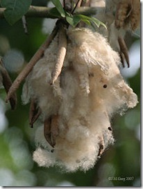
Seasonal bushfires, flooding and erosion evoke an ever-changing mosaic of riverine forest and grasslands along the river banks. On recently depositedalluvium and in lowland areas groups of Catechu (Acacia catechu) with Rosewood (Dalbergia sissoo) predominate, followed by groups of Kapok (Bombax ceiba) with Rhino Apple trees (Trewia nudiflora), the fruits of which rhinos savour so much. Understorey shrubs of Velvety beautyberry (Callicarpa macrophylla), Hill Glory Bower (Clerodendrum sp.) and gooseberry (Phyllanthus emblica) offer shelter and lair to a wide variety of species.
Terai-Duar savanna and grasslands cover about 20% of the park’s area. More than 50 species are found here including some of the world’s tallest grasses like the elephant grass called Saccharum ravennae, Giant cane (Arundo donax), Khagra reed (Phragmites karka) and several species of true grasses. Kans grass (Saccharum spontaneum) is one of the first grasses to colonise new sandbanks and to be washed away by the yearly monsoon floods.
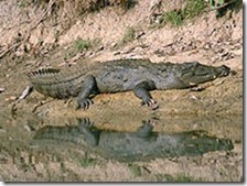
The wide range of vegetation types in the Chitwan National Park is haunt of more than 700 species of wildlife and a not yet fully surveyed number of butterfly,moth and insect species. Apart from King Cobra and Rock python, 17 other species of snakes, starred tortoise and monitor lizards occur. The Narayani-Rapti river system, their small tributaries and myriads of oxbow lakes is habitat for 113 recorded species of fish and mugger crocodiles.
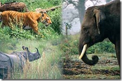
 The Chitwan National Park is home to at least 43 species of mammals. The "King of the Jungle" is the Bengal Tiger. The alluvial floodplain habitat of the Terai is one of the best tiger habitats anywhere in the world. Since the establishment of Chitwan National Park the initially small population of about 25 individuals has increased to 70–110 in 1980. In some years this population has declined due to poaching and floods. In a long-term study carried out from 1995–2002 tiger researchers identified a relative abundance of 82 breeding tigers and a density of 6 females per 100 km2.
Leopards are most prevalent on the peripheries of the park. They co-exist with tigers, but being socially subordinate are not common in prime tiger habitat.]In 1988, a clouded leopard was captured and radio-collared outside the protected area, and released into the park but did not stay.
Other felids reported from the protected area comprise fishing cat, jungle cat, leopard cat, and the rare marbled cat. Chitwan is considered to have the highest population density of sloth bears with an estimated 200 to 250 individuals. Smooth-coated otters inhabit the numerous creeks and rivulets. Golden jackals are common. Bengal foxes, Spotted linsangs, palm civets, Large and Small civets, several species of mongoose, honey badgers and yellow-throated martensroam the jungle for prey. wild dogs are rare. Striped hyenas prevail on the southern slopes of the Churia Hills.

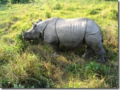
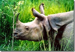
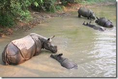
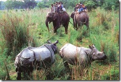
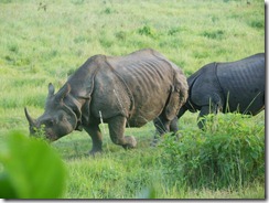
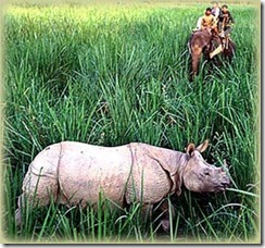
Rhinoceros: since 1973 the population has recovered well and increased to 544 animals around the turn of the century. To ensure the survival of theendangered species in case of epidemics animals are translocated annually from Chitwan to the Bardia National Park and the Sukla Phanta Wildlife Reservesince 1986. However, the population has repeatedly been jeopardized by poaching: in 2002 alone, poachers have killed 37 animals cruelly in order to saw off and sell their valuable horns.
From time to time wild elephant bulls find their way from Valmiki National Park into the valleys of the park, apparently in search of elephant cows willing to be seduced.
Gaurs spend most of the year in the less accessible Churia Hills in the south of the national park. But when the bush fires ease off in springtime and lush grasses start growing up again, they descend into the grassland and riverine forests to graze and browse. The Chitwan population of the world's largest wild cattle species has increased from 188 to 296 animals in the years 1997 to 2007.
Apart from numerous wild boars also sambar deer, Red muntjac, hog deer and herds of chital inhabit the park. Four-horned antelopes reside predominantly in the hills. Rhesus monkeys, hanuman langurs, Indian pangolins, Indian porcupines, several species of flying squirrels, black-naped hares and endangeredhispid hares are also present.
Birds
 Every year dedicated bird watchers and conservationists survey bird species occurring all over the country. In 2006 they recorded 543 species in the Chitwan National Park, much more than in any other protected area in Nepal and about two-thirds of Nepal's globally threatened species. Additionally, 20 black-chinned yuhina, a pair of Gould's sunbird, a pair of blossom-headed parakeet and one slaty-breasted rail, an uncommon winter visitor, were sighted in spring 2008.
Especially the park’s alluvial grasslands are important habitats for the critically endangered Bengal florican, the vulnerable lesser adjutant, grey-crowned prinia, swamp francolin and several species of grass warblers. In 2005 more than 200 slender-billed babblers were sighted in 3 different grassland types.The near threatened Oriental darter is a resident breeder around the many lakes, where also egrets, bitterns, storks and kingfisher abound.
The park is one of the few known breeding sites of the globally threatened spotted eagle.
Peafowl and jungle fowl scratch their living on the forest floor.
Apart from the resident birds about 160 migrating and vagrant species arrive in Chitwan in autumn from northern latitudes to spend the winter here, among them the Greater Spotted Eagle, Eastern Imperial Eagle and Pallas's Fish-eagle. Common sightings include Brahminy ducks and goosanders. Large flocks of bar-headed geese just rest for a few days in February on their way north.
As soon as the winter visitors have left in spring, the summer visitors arrive from southern latitudes. The calls of cuckoos herald the start of spring. The colourful Bengal Pittas and several sunbird species are common breeding visitors during monsoon. Among the many flycatcher species the Paradise flycatcher with his long undulating tail in flight is a spectacular sight.

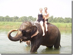
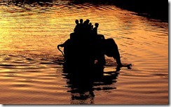
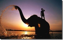
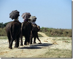
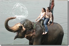
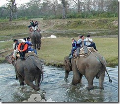
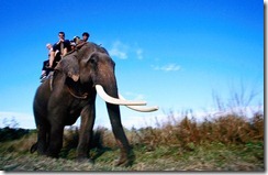
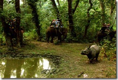
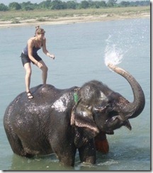
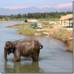
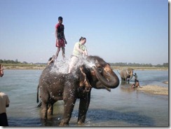
On elephant safari
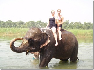
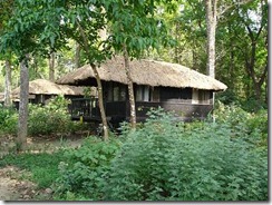
There are several lodges inside the national park offering full board and accommodation in combination with elephant and jeep safaris, rafting tours and guided jungle walks. The pioneer safari lodge is Tiger Tops Jungle Lodge which has been receiving guests since 1972, before the national park was established. Tiger Tops has developed standards for responsible conservation tourism and supports the “Long-term Tiger Monitoring Project” of the International Trust for Nature Conservation and anti-poaching units operating in the national park.
On the edge of the national park Sauraha is a well-known spot for tourists. Accessible from the nearby Bharatpur Airport, Sauraha offers a choice of hotels, lodges, restaurants and agencies that organize day trips into the protected area.
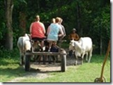
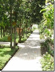
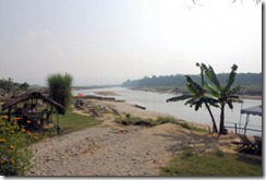
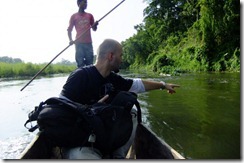
Few Image
-------------------------------------------------------------------------------------------------------
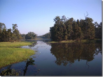 Beeshazari Lake Chtwan
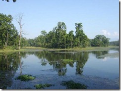
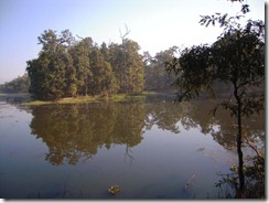
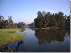
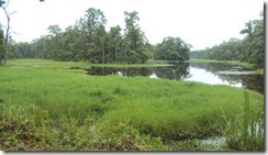
विसहजारी र सहायक तालहरु एउटा तालहरुको समुुह हो । यो चितवन जिल्लाको भरतपुर नगरपालिका वडा नं. ८, ९ र गितानगर गाविस वडा नं. ९, ६ र ४ लगाएतका ठाउ“को नजिक बनदेवि वरण्डाभार मध्यवति सामुदायिक बन भित्र चितवन राष्ट्रिय निकुञ्जको मध्यवर्ती क्षेत्रमा अवस्थित छ ।
विसहजारी ताल वरण्डाभार बनक्षेत्र भित्र रहेको तालहरुको समुहको सवैभन्दा ठुलो र महत्वपूर्ण ताल हो । यसको भौगोलिक अवस्थिति २७ डिग्रि ३७ मिनट उत्तर अक्षांश र ८४ डिग्रि २६ मिनट पुर्वि देशान्तरमा रहेको छ । चितवन राष्ट्रिय निकुञ्ज विश्व सम्पदा सुचिमा समेत संरक्षित रहेकाले यस तालको महत्व अझ थपिएको छ । वरिपरि घना जंगलले घेरिएको यसतला र शाखातालहरुको क्षेत्रफल करिव ३२ सय हेक्टर अर्थात ४८ सय विगाहा रहेको छ ।
महाभारत पर्वत श्रङ्खलाको दक्षिण र चुरेपर्वत श्रङ्खलाको उत्तरतर्फ भित्रिमधेशको उष्ण सालवन भित्र रहेको यस तालमा महत्वपूर्ण पानीको श्रोत र अति दुर्लभ तथा संरक्षित वन्य जन्तुहरु पाटेबाघ, गैडा, काठ भालु, घडियाल तथा मगर गोहि, गिद्ध, माछा खाने चिल, पानीहास लागाएतको आवतजावत गर्ने महत्वपुर्ण कोरीडोर क्षेत्र पर्दछ ।
यस तालको वरिपरि रहेको तालको व्यवस्थापन पहिले माछाको ठेक्कामा आधारित थियो । लाखौ जनताको नजिक रहेको र यहका जनताहरु कृषि पेशामा नै आधारित भएकोले यसताल घरपालुवा बस्तुहरुको लागि पानी तथा चरन श्रोतको रुपमा रहेको थियो ।
पछिल्लो दशकमा जनजिवनमा आएको परिर्वतका आतिरिक्त बनक्षेत्रमा सामुदायिक वन व्यवस्थापन तथा संरक्षण कार्यक्रले गर्दा वनक्षेत्रमा पशु चरनमा निषेध गर्ेपछि भएको बनको संरक्षण तथा २००३ सालको अक्टोवर महिनाको १३ गते देखि यो ताल विश्वको महत्वपुर्ण सिमसार क्षेत्रको रुपमा परिणत भएपछि यसको महत्व अरुबढि थपिएको हो ।
अन्तराष्ट्रिय महत्वको सिमसार क्षेत्रको अवधारणा अन्तरगत अन्तरदेशीय अभिसन्धिहरु मध्यको एउटा महत्वपुर्ण सम्झौता हो । क्यास्पीयन सागरको तटीय क्षेत्रमा रहेको राज्य इरानको रामसार सहरमा भएको पारिस्थितिक प्रणालि सम्वन्धि एक विशेष अभिसन्धि सन १९७१ फ्रेवु्रअरी २ मा गरिएपछि सिमसार क्षेत्र संरक्षणमा राष्ट्रिय तथा अन्तराष्ट्रिय संघसस्थाहरुको ध्यानआकार्शण भएको छ । तराइको समुन्द्रि सहत देखि २ सय ८६ मिटर उचाइमा रहेको विसहजारी ताल प्राकृतिक भने होइन , तत्कालीन नेपाल सरकारले पश्चिम चितवनका कृषियोग्य जमिनलाई सिंचित गर्न पुर्वि चितवनको खगेरि नहर प्रणालीबाट ल्याइएको नहरको पानी तथा यस तालको जलाधारक्षत्रेबाट संकलित पानीबाट यस क्षेत्रमा तालको सिर्जना भएको हो । आज भन्दा दशकौ अगाडि देखि पानी स्वच्छ र सफा दियो किनकि त्यसमा एक प्रकारको प्राकृतिक प्रकृयाको निरन्तरता थियो । जव तालमा अनावश्यक संरचनाहरुको निमार्ण गर्न थालियो र तालको स्वरुपलाई विर्गाने कार्य मुख्यत सरकारी सरोकार निकायबाट हुन थाले पछि तालमा झार उर्मने कार्यमा तिव्रता आएको हो ।
जव यो तालक्षेत्र अन्तराष्ट्रिय महत्वको सिमसारक्षेत्रको रुपमा स्थापित भयो त्यस सगै विभिन्न राष्ट्रिय तथा अन्तराष्ट्रिय सघ सस्था, सरोकारवालाहरु र स्थानियहरुको समेत ध्यानाकर्षण भएको छ । यस अवस्थामा विभिन्न निकायहरुले फरक फरक मनासायले यस स्रोतको उपयोग गरेको पनि देखिन्छ । स्रोतको सवैभन्दा नजिकको सरोकारवालाहरुको स्रोतमा अग्राधिकार रहने मान्यता राष्ट्रिय तथा अन्तराष्ट्रियरुपमा पनि स्थापना भइरहेको हुनाले यसमा सवैभन्दा नजिकको बासिन्दा हुनुको नाताले यस क्षेत्रमा यो स्रोत माथि हामि स्थानीयको सवैभन्दा पहिलो सरोकार हो भन्ने मान्यता स्थापना गर्न चाहन्छौ । त्यसकारण यसको संरक्षण र सदुपयोग तालको सवैभन्दा नजिक बस्ने स्थानीय जनताको सक्रीय र प्रत्यक्ष सहभागितामा हुनुपर्ने कुरामा हाम्रो जिकिर पनि रहेको छ । नेपाल सरकार लगायत सवै राष्टिय तथा अन्तराष्टिय सरकारी तथा गैरसरकारि संस्थाहरु, स्थानीय निकायहरु, तथा पर्यापर्यटन र अन्य व्यवसाहिक संघसस्थाहरु जो तालको स्रोतमा आधारित छन् उनिहरुलाई यो सवै जानकारी गराउन पनि चाहन्छौ ।
यस कुरालाई मध्यनजर राख्दै यस क्षेत्रका स्थानीय वुद्धिजिवि, समाजसेवि र युवा वर्गहरुको भेलाबाट यो वन क्षेत्र हाम्रो हो भन्ने उदेश्यका साथ प्रकृति तथा विसहजारी तालको संरक्षण एवं सम्वद्धन र सदुपयोग गर्न यस क्षेत्रको दाहित्वको महशुस गरि उक्त भेलाबाट प्रकृति तथा विसहजारी ताल संरक्षण समिति गठन भई उक्त समितिबाट विभिन्न कार्यक्रमहरु संचालन हुदै आएको छ ।
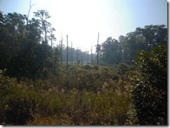
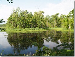
Few Image Of this Lake
------------------------------------------------------------------------------------------------------------
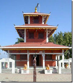 MAULA KALIKA GAINDAKOT
Maula Kalika is a famous Hindu temple of Goddess Kalika in Gaindakot town of Nawalparasi district in Lumbini zone of Nepal.
Maula Kalika is a very famous and growing tourist destination located in Gaindakot town of Nepal. Located on the top of the Maula hill on the north of Narayani River (also called Gandaki River) in Gaindakot, Maula Kalika temple is situated 561 meter above the sea level.
History
Historically, it is said that in 16th century the King of Palpa created a symbolic offering site ("Maula") in the name of goddess Kalika after which the name of the mountain (Maula hill) was derived.
It is believed, in Hindu mythology that the Goddess Kali or Kalika also called Durga is the symbol of energy, power and new beginning.
Popularity
Local people in Gaindakot have been worshiping at the Maula Kalika for many centuries before it got wide spread popularity quite recently. The current temple was built in the early 1990's.
Hundreds of thousands of people visit Maula Kalika every year from Nepal and neighboring countries. Dasain or Dussera festival in September-October and in March-April are peak seasons when goddess Kalika (also called Nav Durga, the 9 different incarnation of Goddess Kalika) is worshiped during these festive season.
President of Nepal Dr. Ram Baran Yadav, former King/Princes and government officials of Nepal and world famous Yoga guru Baba Ramdev from India recently visited the temple.
Hiking
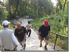
Regular visitors from Gaindakot and nearby towns of Narayanghat, Bharatpur and Chitwan to this place choose as a destination to entertain their leisure time with the feel of cool breeze, observation of wide panoramic views of wilderness and exciting adventure of walking through 2000 meters long slopy & curvy stairs to attain the height of final destination.
Visitors enjoy panoramic view of Narayani River, Gaindakot town and Chitwan Valley on the south of the hill. Mt.Manaslu can be viewed on the north side. Hikers also prefer to visit the temple for good-morning sunrise view early in the morning.
It is trending that tourists now who visit Chitwan National Park and Lumbini also add Maula Kalika in Gaindakot as an additional most-visit tourist destination in their itinerary. It takes less than a half-day for a round trip hiking from Narayanghat town traveling on foot. From the bottom of the Maula hill it only requires less than 4 hours for top and down. Mineral water and refreshments are available on the way, near Deurali where there is a helipad too.
Transportaion
By AirThe closest domestic airport is Bharatpur Airport, where daily flights are available to and from Kathmandu and Pokhara. It takes less then a hour from Kathmandu airport (Tribhuvan International Airport) to reach Bharatpur (near Gaindakot) on air.
By BusIt's a 5 hour drive from the capital city Kathmandu. Travel from Lumbini (the birthplace of Lord Buddha in Nepal) and Birganj near the Indian border is about 3 hours journey by bus or car.
Local TransportTaxi's, rickshaw's are available in Narayanghat town. Narayanghat is less than 15 minutes walk from Gaindakot.
By RailroadThere is no railway system in Nepal (see Nepal Railways) except a small line service in Janakpur, Nepal. Visitors from India or China can take a bus (or taxi if available) from Nepal border.
MORE INFORMATION ABOUT MAULA KALIKA TEMPLE
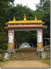
Located in the premises of holy religious site Devghat Dham, the Maula Kalika temple is a famous religious pilgrimage and tourist site. The temple is situated on the hilltop, around a kilometer north of the East-West Highway in Gaindakot VDC-1 of Nawalparasi lying in the lap of the Narayani River in the mid-part of Nepal. To reach the temple, it takes two kilometers trek to hill upward from three kilometers west of Narayanghat of Chitwan. One has to cross 1,892 footsteps to reach up to the temple.
The temple is highly-acclaimed from the point of view of religious tourism and ecology for its location in the altitude of 561 metres from sea-level in the summit above the holy shrines of Devghat, which is nestled at the confluence of three rivers- the Narayani, the Kali Gandaki and the Trisuli originating from Damodarkunda and Gosainkunda and on the junction of Nawalparasi, Chitwan and Tanahun districts. This natural location of temple has enhanced her touristy and spiritual attraction. Devghat is regarded as the best and most ancient of the prayagas (confluence of two rivers).
Situated on the hilltop amidst dense green forest, it is gaining recognition as a spiritual centre as well as a holy place for fulfilling the wishes expressed by devotees and worshippers before the Goddess. Devotees throng the temple every morning to offer worships and prayers to the Goddess who is believed to materialize people’s longings.
With the increased beauty and panorama of the place with the systematic prayers to the temple since 2038 BS, infrastructure development on the people’s mobilization and constructions of temple in pyagoda style in 2052 BS, the score of visitors has remarkably gone up in the temple for last few years. The snow-capped scenic beauty in the north, holy place Devghat, Chitwan National Park, Sauraha, Tigers Top, and other enchanting natural beauty visible to the north from the temple delight every tourists reaching there. Likewise, people-conserved peace forest park (Banbatika), artistic slate-paved way, stands, tap stands, stations, and various temples on the way to Maulakali are also inspiring people to visit the temple again and again.
Worth-seeing scenes from the hilltop and the pleasure one feels from trekking and wandering green dense forests also mesmerize people there, rocketing the number of visitors arriving in this altitude from all parts of the country thereby help promote internal tourism in the area.
Visitors can offer prayer and worship to Siddi Binayak Ganesh, Shree Krishna and Deurali Devi on the way to Maulakalika andtake joy of the incredible natural beauty intensified by the forest and cool and clean weather on the way to the temple.
There has been public belief that their wishes have been accomplished following the worship to the Goddess Kalika believed to impart conspicuous divine power. Hence, devotees and youths are said to have attained their cherished wishes and intended love with the adoration of Bhagawati.
The beautiful statues and idols of Mahakali, Mahalaxmi and Mahasaraswori, female deities as well as Tulsimath and Shivalinga have been set up in the temple premises. Likewise, the temple is well-equipped with RCC kitchen building, room for guests and religious citations, welcome gate, hospitality building and so on. There has also been sound management of drinking water and electricity in the temple.
Visitors felt very difficult to reach the temple a decade before. Everyone is taken aback with the unimagined development of the area when s/he visits the temple after ten years. The temple is a quintessence of human efforts and endeavors, showing what people cannot do with their strong commitment and unwavering will.
ABOUT MT. EVEREST (The highest peak of the world)

Isn't amazing? It is said that Narilatha flower plants grow in the Himalayan region in India and they bloom at 20-year intervals. The trance of hermits is said to be shattered at the sight of these flowers which are in the shape of women .This flower was in the shape of a naked woman, and said to be as a rare flower.
Images for Narilatha Flower


---------------------------------------------------------------------------------------------------------------------------------------------------------------------------------------------------------------------
 Manakamana is the name of a Hindu Goddess. It is believed that the Goddess fulfils the wishes of the people. The term ‘mana’ means the ‘heart’ or ‘soul’ and ‘kamana’ means the ‘wish’.
The most popular temple of Manakamana is in Gorkha. The others are in various places like manakamana. It is said that a King of Gorkha was blessed by the goddess to get victory over small kingdoms and make a big Gorkha. Manakamana of gorkha is a popular place for a specific fair called Panchami. The temple was initially inaccessible and one had to ride on horseback for 2–3 days. Now it is easily accessible by Cable Car.
History
The queen of Ram Shah, the king of Gorkha born in 1614 AD, was a goddess known to only her devotee, Lakhan Thapa. One day the king saw his queen in the form of a goddess. He told about it to Lakhan Thapa and he died instantly, in 1636 AD. The queen committed Sati (commit cremation with the husband's pyre as per custom of that time). Lakhan Thapa lamented on her Sati.The queen consoled him to reappear again. Six months later, a farmer hit a stone while ploughing his field. Blood and milk came out from the stone. Lakhan Thapa came to know the news. He worshipped the place with 'tantric' rituals. The flow of blood and milk ceased. The site became the foundation of the present-day shrine- Manakamana Temple. Manakamana meaning wishes fulfilling goddess. The current pujari, Priest, is the 17th generation descendant of Lakhan Thapa.Transportation
There is cable car service, the only cable car service in Nepal, from Kurintar to Manakamana, It is 10 minutes cable car ride from Kurintar to Manakamana. Kurintar is 95 km, 2 hours drive, from Kathmandu on the way to Pokhara. Kurintar is at an altitude of 258 meter high from sea level. When there was no cable car service people used to walk 3–4 hours all the way to Manakamana. Due to the Cable Car it is now very easy to get to this one of the most famous religious destination.Mankamana Cable car ride

Manakamana is the name of a Hindu Goddess. It is believed that the Goddess fulfils the wishes of the people. The term ‘mana’ means the ‘heart’ or ‘soul’ and ‘kamana’ means the ‘wish’.The most popular temple of Manakamana is in Gorkha.it is 95km from Kathmandu and one can enjoy the true cable car ride at the Himalayan kingdom of Nepal with the beautiful scenic view of mountains and Trishuli river.
After breakfast our tour guide and vehicle assists you at your hotel and 3 hrs drive to Kurintar and ride a cable car to visit Manakamana temple Lunch at Manakamana with the spectacular view of high snowcapped mountains and sighseeing of the ancient Manakamana temple and back to Kurintar and drive back to Kathmandu.
IMAGE FOR CABLE CAR


IMAGE FOR MANKAMANA TEMPLE


-----------------------------------------------------------------------------------------------

Chitwan National Park
Chitwan National Park is the first national park in Nepal. Formerly called Royal Chitwan National Park it was established in 1973 and granted the status of a World Heritage Site in 1984. It covers an area of 932 km2 (360 sq mi) and is located in the subtropical Inner Terai lowlands of south-central Nepal in the Chitwan District. In altitude it ranges from about 100 metres (330 ft) in the river valleys to 815 metres (2,674 ft) in the Churia Hills.
In the north and west of the protected area the Narayani-Rapti river system forms a natural boundary to human settlements. Adjacent to the east of Chitwan National Park is Parsa Wildlife Reserve, contiguous in the south is the Indian Tiger Reserve Valmiki National Park. The coherent protected area of 2,075 km2 (801 sq mi) represents the Tiger Conservation Unit (TCU) Chitwan-Parsa-Valmiki, which covers a 3,549 km2 (1,370 sq mi) huge block of alluvial grasslands and subtropical moist deciduous forests.
History
Since the end of the 19th century Chitwan - Heart of the Jungle – used to be a favorite hunting ground for Nepal’s ruling class during the winter seasons. Until the 1950s, the journey from Kathmandu to Nepal’s South was arduous as the area could only be reached by foot. Thus, in an area known as Four Mile Forest (चार कोसे झाडी) comfortable camps were set up for the feudal big game hunters and their entourage, where they stayed for a couple of months shooting hundreds of tigers, rhinocerosses, leopards and sloth bears.In 1950, Chitwan’s forest and grasslands extended over more than 2,600 km2 (1,000 sq mi) and was home to about 800 rhinos. When poor farmers from the mid-hills moved to the Chitwan Valley in search of arable land, the area was subsequently opened for settlement, and poaching of wildlifebecame rampant. In 1957, the country's first conservation law inured to the protection of rhinos and their habitat. In 1959, Edward Pritchard Geeundertook a survey of the area, recommended creation of a protected area north of the Rapti River and of a wildlife sanctuary south of the river for a trial period of ten years. After his subsequent survey of Chitwan in 1963, this time for both the Fauna Preservation Society and the International Union for Conservation of Nature, he recommended extension of the sanctuary to the south.
By the end of the 1960s, 70% of Chitwan’s jungles were cleared using DDT, thousands of people had settled there, and only 95 rhinos remained. The dramatic decline of the rhino population and the extent of poaching prompted the government to institute the Gaida Gasti – a rhino reconnaissance patrol of 130 armed men and a network of guard posts all over Chitwan. To prevent the extinction of rhinos the Chitwan National Park was gazetted in December 1970, with borders delineated the following year and established in 1973, initially encompassing an area of 544 km2 (210 sq mi).
In 1977, the park was enlarged to its present area of 932 km2 (360 sq mi). In 1997, a bufferzone of 766.1 km2 (295.8 sq mi) was added to the north and west of the Narayani-Rapti river system, and between the south-eastern boundary of the park and the international border to India.
The park’s headquarter is located in Kasara. Close-by the Gharial and Turtle Conservation Breeding Centres have been established. In 2008, a Vulture breeding centre was inaugurated aiming at holding up to 25 pairs of each of the two Gyps vultures species now critically endangered in Nepal - the Oriental white-backed vulture and the slender-billed vulture.
Climate
The area is located in the central climatic zone of the Himalayas, where monsoon starts in mid June and eases off in late September. During these 14–15 weeks most of the 2,500 mm yearly precipitation falls – it is pouring with rain. After mid-October the monsoon clouds have retreated, humidity drops off, and the top daily temperature gradually subsides from ±36°C / 96.8 °F to ±18°C / 64.4 °F. Nights are cooling down to 5°C / 41.0 °F until late December, when it usually rains softly for a few days. Then temperatures are rising gradually.
Vegetation
The typical vegetation of the Inner Terai is Himalayan subtropical broadleaf forests with predominantly Sal trees covering about 70% of the national park area. Purest stands of sal occur on well drained lowland ground in the centre. Along the southern face of the Churia Hills sal is interspersed with chir pine (Pinus roxburghii). On northern slopes sal associates with smaller flowering tree and shrub species such as Beleric (Terminalia bellirica), Rosewood (Dalbergia sissoo), Axlewood (Anogeissus latifolia), Elephant Apple (Dillenia indica), Grey Downy Balsam (Garuga pinnata) and creepers such as Bauhinia vahlii andSpatholobus parviflorus.Seasonal bushfires, flooding and erosion evoke an ever-changing mosaic of riverine forest and grasslands along the river banks. On recently depositedalluvium and in lowland areas groups of Catechu (Acacia catechu) with Rosewood (Dalbergia sissoo) predominate, followed by groups of Kapok (Bombax ceiba) with Rhino Apple trees (Trewia nudiflora), the fruits of which rhinos savour so much. Understorey shrubs of Velvety beautyberry (Callicarpa macrophylla), Hill Glory Bower (Clerodendrum sp.) and gooseberry (Phyllanthus emblica) offer shelter and lair to a wide variety of species.
Terai-Duar savanna and grasslands cover about 20% of the park’s area. More than 50 species are found here including some of the world’s tallest grasses like the elephant grass called Saccharum ravennae, Giant cane (Arundo donax), Khagra reed (Phragmites karka) and several species of true grasses. Kans grass (Saccharum spontaneum) is one of the first grasses to colonise new sandbanks and to be washed away by the yearly monsoon floods.

Fauna
The wide range of vegetation types in the Chitwan National Park is haunt of more than 700 species of wildlife and a not yet fully surveyed number of butterfly,moth and insect species. Apart from King Cobra and Rock python, 17 other species of snakes, starred tortoise and monitor lizards occur. The Narayani-Rapti river system, their small tributaries and myriads of oxbow lakes is habitat for 113 recorded species of fish and mugger crocodiles.
In the early 1950s, about 235 gharials occurred in the Narayani River. The population has dramatically declined to only 38 wild gharials in 2003. Every year gharial eggs are collected along the rivers to be hatched in the breeding center of the Gharial Conservation Project, where animals are reared to an age of 6–9 years. Every year young gharials are reintroduced into the Narayani-Rapti river system, of which sadly only very few survive.
Mammals
 The Chitwan National Park is home to at least 43 species of mammals. The "King of the Jungle" is the Bengal Tiger. The alluvial floodplain habitat of the Terai is one of the best tiger habitats anywhere in the world. Since the establishment of Chitwan National Park the initially small population of about 25 individuals has increased to 70–110 in 1980. In some years this population has declined due to poaching and floods. In a long-term study carried out from 1995–2002 tiger researchers identified a relative abundance of 82 breeding tigers and a density of 6 females per 100 km2.
Leopards are most prevalent on the peripheries of the park. They co-exist with tigers, but being socially subordinate are not common in prime tiger habitat.]In 1988, a clouded leopard was captured and radio-collared outside the protected area, and released into the park but did not stay.
Other felids reported from the protected area comprise fishing cat, jungle cat, leopard cat, and the rare marbled cat. Chitwan is considered to have the highest population density of sloth bears with an estimated 200 to 250 individuals. Smooth-coated otters inhabit the numerous creeks and rivulets. Golden jackals are common. Bengal foxes, Spotted linsangs, palm civets, Large and Small civets, several species of mongoose, honey badgers and yellow-throated martensroam the jungle for prey. wild dogs are rare. Striped hyenas prevail on the southern slopes of the Churia Hills.

Rhinoceros: since 1973 the population has recovered well and increased to 544 animals around the turn of the century. To ensure the survival of theendangered species in case of epidemics animals are translocated annually from Chitwan to the Bardia National Park and the Sukla Phanta Wildlife Reservesince 1986. However, the population has repeatedly been jeopardized by poaching: in 2002 alone, poachers have killed 37 animals cruelly in order to saw off and sell their valuable horns.
From time to time wild elephant bulls find their way from Valmiki National Park into the valleys of the park, apparently in search of elephant cows willing to be seduced.
Gaurs spend most of the year in the less accessible Churia Hills in the south of the national park. But when the bush fires ease off in springtime and lush grasses start growing up again, they descend into the grassland and riverine forests to graze and browse. The Chitwan population of the world's largest wild cattle species has increased from 188 to 296 animals in the years 1997 to 2007.
Apart from numerous wild boars also sambar deer, Red muntjac, hog deer and herds of chital inhabit the park. Four-horned antelopes reside predominantly in the hills. Rhesus monkeys, hanuman langurs, Indian pangolins, Indian porcupines, several species of flying squirrels, black-naped hares and endangeredhispid hares are also present.
Birds
 Every year dedicated bird watchers and conservationists survey bird species occurring all over the country. In 2006 they recorded 543 species in the Chitwan National Park, much more than in any other protected area in Nepal and about two-thirds of Nepal's globally threatened species. Additionally, 20 black-chinned yuhina, a pair of Gould's sunbird, a pair of blossom-headed parakeet and one slaty-breasted rail, an uncommon winter visitor, were sighted in spring 2008.
Especially the park’s alluvial grasslands are important habitats for the critically endangered Bengal florican, the vulnerable lesser adjutant, grey-crowned prinia, swamp francolin and several species of grass warblers. In 2005 more than 200 slender-billed babblers were sighted in 3 different grassland types.The near threatened Oriental darter is a resident breeder around the many lakes, where also egrets, bitterns, storks and kingfisher abound.
The park is one of the few known breeding sites of the globally threatened spotted eagle.
Peafowl and jungle fowl scratch their living on the forest floor.
Apart from the resident birds about 160 migrating and vagrant species arrive in Chitwan in autumn from northern latitudes to spend the winter here, among them the Greater Spotted Eagle, Eastern Imperial Eagle and Pallas's Fish-eagle. Common sightings include Brahminy ducks and goosanders. Large flocks of bar-headed geese just rest for a few days in February on their way north.
As soon as the winter visitors have left in spring, the summer visitors arrive from southern latitudes. The calls of cuckoos herald the start of spring. The colourful Bengal Pittas and several sunbird species are common breeding visitors during monsoon. Among the many flycatcher species the Paradise flycatcher with his long undulating tail in flight is a spectacular sight.
Tourism
Chitwan National Park is one of Nepal’s most popular Tourist destinations. In 1989 more than 31,000 people visited the park, and ten years later already more than 77,000.
On elephant safari
There are several lodges inside the national park offering full board and accommodation in combination with elephant and jeep safaris, rafting tours and guided jungle walks. The pioneer safari lodge is Tiger Tops Jungle Lodge which has been receiving guests since 1972, before the national park was established. Tiger Tops has developed standards for responsible conservation tourism and supports the “Long-term Tiger Monitoring Project” of the International Trust for Nature Conservation and anti-poaching units operating in the national park.
On the edge of the national park Sauraha is a well-known spot for tourists. Accessible from the nearby Bharatpur Airport, Sauraha offers a choice of hotels, lodges, restaurants and agencies that organize day trips into the protected area.
Few Image


-------------------------------------------------------------------------------------------------------
 Beeshazari Lake Chtwan
विसहजारी र सहायक तालहरु एउटा तालहरुको समुुह हो । यो चितवन जिल्लाको भरतपुर नगरपालिका वडा नं. ८, ९ र गितानगर गाविस वडा नं. ९, ६ र ४ लगाएतका ठाउ“को नजिक बनदेवि वरण्डाभार मध्यवति सामुदायिक बन भित्र चितवन राष्ट्रिय निकुञ्जको मध्यवर्ती क्षेत्रमा अवस्थित छ ।
विसहजारी ताल वरण्डाभार बनक्षेत्र भित्र रहेको तालहरुको समुहको सवैभन्दा ठुलो र महत्वपूर्ण ताल हो । यसको भौगोलिक अवस्थिति २७ डिग्रि ३७ मिनट उत्तर अक्षांश र ८४ डिग्रि २६ मिनट पुर्वि देशान्तरमा रहेको छ । चितवन राष्ट्रिय निकुञ्ज विश्व सम्पदा सुचिमा समेत संरक्षित रहेकाले यस तालको महत्व अझ थपिएको छ । वरिपरि घना जंगलले घेरिएको यसतला र शाखातालहरुको क्षेत्रफल करिव ३२ सय हेक्टर अर्थात ४८ सय विगाहा रहेको छ ।
महाभारत पर्वत श्रङ्खलाको दक्षिण र चुरेपर्वत श्रङ्खलाको उत्तरतर्फ भित्रिमधेशको उष्ण सालवन भित्र रहेको यस तालमा महत्वपूर्ण पानीको श्रोत र अति दुर्लभ तथा संरक्षित वन्य जन्तुहरु पाटेबाघ, गैडा, काठ भालु, घडियाल तथा मगर गोहि, गिद्ध, माछा खाने चिल, पानीहास लागाएतको आवतजावत गर्ने महत्वपुर्ण कोरीडोर क्षेत्र पर्दछ ।
यस तालको वरिपरि रहेको तालको व्यवस्थापन पहिले माछाको ठेक्कामा आधारित थियो । लाखौ जनताको नजिक रहेको र यहका जनताहरु कृषि पेशामा नै आधारित भएकोले यसताल घरपालुवा बस्तुहरुको लागि पानी तथा चरन श्रोतको रुपमा रहेको थियो ।
पछिल्लो दशकमा जनजिवनमा आएको परिर्वतका आतिरिक्त बनक्षेत्रमा सामुदायिक वन व्यवस्थापन तथा संरक्षण कार्यक्रले गर्दा वनक्षेत्रमा पशु चरनमा निषेध गर्ेपछि भएको बनको संरक्षण तथा २००३ सालको अक्टोवर महिनाको १३ गते देखि यो ताल विश्वको महत्वपुर्ण सिमसार क्षेत्रको रुपमा परिणत भएपछि यसको महत्व अरुबढि थपिएको हो ।
अन्तराष्ट्रिय महत्वको सिमसार क्षेत्रको अवधारणा अन्तरगत अन्तरदेशीय अभिसन्धिहरु मध्यको एउटा महत्वपुर्ण सम्झौता हो । क्यास्पीयन सागरको तटीय क्षेत्रमा रहेको राज्य इरानको रामसार सहरमा भएको पारिस्थितिक प्रणालि सम्वन्धि एक विशेष अभिसन्धि सन १९७१ फ्रेवु्रअरी २ मा गरिएपछि सिमसार क्षेत्र संरक्षणमा राष्ट्रिय तथा अन्तराष्ट्रिय संघसस्थाहरुको ध्यानआकार्शण भएको छ । तराइको समुन्द्रि सहत देखि २ सय ८६ मिटर उचाइमा रहेको विसहजारी ताल प्राकृतिक भने होइन , तत्कालीन नेपाल सरकारले पश्चिम चितवनका कृषियोग्य जमिनलाई सिंचित गर्न पुर्वि चितवनको खगेरि नहर प्रणालीबाट ल्याइएको नहरको पानी तथा यस तालको जलाधारक्षत्रेबाट संकलित पानीबाट यस क्षेत्रमा तालको सिर्जना भएको हो । आज भन्दा दशकौ अगाडि देखि पानी स्वच्छ र सफा दियो किनकि त्यसमा एक प्रकारको प्राकृतिक प्रकृयाको निरन्तरता थियो । जव तालमा अनावश्यक संरचनाहरुको निमार्ण गर्न थालियो र तालको स्वरुपलाई विर्गाने कार्य मुख्यत सरकारी सरोकार निकायबाट हुन थाले पछि तालमा झार उर्मने कार्यमा तिव्रता आएको हो ।
जव यो तालक्षेत्र अन्तराष्ट्रिय महत्वको सिमसारक्षेत्रको रुपमा स्थापित भयो त्यस सगै विभिन्न राष्ट्रिय तथा अन्तराष्ट्रिय सघ सस्था, सरोकारवालाहरु र स्थानियहरुको समेत ध्यानाकर्षण भएको छ । यस अवस्थामा विभिन्न निकायहरुले फरक फरक मनासायले यस स्रोतको उपयोग गरेको पनि देखिन्छ । स्रोतको सवैभन्दा नजिकको सरोकारवालाहरुको स्रोतमा अग्राधिकार रहने मान्यता राष्ट्रिय तथा अन्तराष्ट्रियरुपमा पनि स्थापना भइरहेको हुनाले यसमा सवैभन्दा नजिकको बासिन्दा हुनुको नाताले यस क्षेत्रमा यो स्रोत माथि हामि स्थानीयको सवैभन्दा पहिलो सरोकार हो भन्ने मान्यता स्थापना गर्न चाहन्छौ । त्यसकारण यसको संरक्षण र सदुपयोग तालको सवैभन्दा नजिक बस्ने स्थानीय जनताको सक्रीय र प्रत्यक्ष सहभागितामा हुनुपर्ने कुरामा हाम्रो जिकिर पनि रहेको छ । नेपाल सरकार लगायत सवै राष्टिय तथा अन्तराष्टिय सरकारी तथा गैरसरकारि संस्थाहरु, स्थानीय निकायहरु, तथा पर्यापर्यटन र अन्य व्यवसाहिक संघसस्थाहरु जो तालको स्रोतमा आधारित छन् उनिहरुलाई यो सवै जानकारी गराउन पनि चाहन्छौ ।
यस कुरालाई मध्यनजर राख्दै यस क्षेत्रका स्थानीय वुद्धिजिवि, समाजसेवि र युवा वर्गहरुको भेलाबाट यो वन क्षेत्र हाम्रो हो भन्ने उदेश्यका साथ प्रकृति तथा विसहजारी तालको संरक्षण एवं सम्वद्धन र सदुपयोग गर्न यस क्षेत्रको दाहित्वको महशुस गरि उक्त भेलाबाट प्रकृति तथा विसहजारी ताल संरक्षण समिति गठन भई उक्त समितिबाट विभिन्न कार्यक्रमहरु संचालन हुदै आएको छ ।
Few Image Of this Lake


------------------------------------------------------------------------------------------------------------
 MAULA KALIKA GAINDAKOT
Maula Kalika is a famous Hindu temple of Goddess Kalika in Gaindakot town of Nawalparasi district in Lumbini zone of Nepal.
Maula Kalika is a very famous and growing tourist destination located in Gaindakot town of Nepal. Located on the top of the Maula hill on the north of Narayani River (also called Gandaki River) in Gaindakot, Maula Kalika temple is situated 561 meter above the sea level.
History
Historically, it is said that in 16th century the King of Palpa created a symbolic offering site ("Maula") in the name of goddess Kalika after which the name of the mountain (Maula hill) was derived.
It is believed, in Hindu mythology that the Goddess Kali or Kalika also called Durga is the symbol of energy, power and new beginning.
Popularity
Local people in Gaindakot have been worshiping at the Maula Kalika for many centuries before it got wide spread popularity quite recently. The current temple was built in the early 1990's.
Hundreds of thousands of people visit Maula Kalika every year from Nepal and neighboring countries. Dasain or Dussera festival in September-October and in March-April are peak seasons when goddess Kalika (also called Nav Durga, the 9 different incarnation of Goddess Kalika) is worshiped during these festive season.
President of Nepal Dr. Ram Baran Yadav, former King/Princes and government officials of Nepal and world famous Yoga guru Baba Ramdev from India recently visited the temple.

Hiking
Regular visitors from Gaindakot and nearby towns of Narayanghat, Bharatpur and Chitwan to this place choose as a destination to entertain their leisure time with the feel of cool breeze, observation of wide panoramic views of wilderness and exciting adventure of walking through 2000 meters long slopy & curvy stairs to attain the height of final destination.
Visitors enjoy panoramic view of Narayani River, Gaindakot town and Chitwan Valley on the south of the hill. Mt.Manaslu can be viewed on the north side. Hikers also prefer to visit the temple for good-morning sunrise view early in the morning.
It is trending that tourists now who visit Chitwan National Park and Lumbini also add Maula Kalika in Gaindakot as an additional most-visit tourist destination in their itinerary. It takes less than a half-day for a round trip hiking from Narayanghat town traveling on foot. From the bottom of the Maula hill it only requires less than 4 hours for top and down. Mineral water and refreshments are available on the way, near Deurali where there is a helipad too.
Transportaion
By AirThe closest domestic airport is Bharatpur Airport, where daily flights are available to and from Kathmandu and Pokhara. It takes less then a hour from Kathmandu airport (Tribhuvan International Airport) to reach Bharatpur (near Gaindakot) on air.
By BusIt's a 5 hour drive from the capital city Kathmandu. Travel from Lumbini (the birthplace of Lord Buddha in Nepal) and Birganj near the Indian border is about 3 hours journey by bus or car.
Local TransportTaxi's, rickshaw's are available in Narayanghat town. Narayanghat is less than 15 minutes walk from Gaindakot.
By RailroadThere is no railway system in Nepal (see Nepal Railways) except a small line service in Janakpur, Nepal. Visitors from India or China can take a bus (or taxi if available) from Nepal border.
MORE INFORMATION ABOUT MAULA KALIKA TEMPLE

Located in the premises of holy religious site Devghat Dham, the Maula Kalika temple is a famous religious pilgrimage and tourist site. The temple is situated on the hilltop, around a kilometer north of the East-West Highway in Gaindakot VDC-1 of Nawalparasi lying in the lap of the Narayani River in the mid-part of Nepal. To reach the temple, it takes two kilometers trek to hill upward from three kilometers west of Narayanghat of Chitwan. One has to cross 1,892 footsteps to reach up to the temple.
The temple is highly-acclaimed from the point of view of religious tourism and ecology for its location in the altitude of 561 metres from sea-level in the summit above the holy shrines of Devghat, which is nestled at the confluence of three rivers- the Narayani, the Kali Gandaki and the Trisuli originating from Damodarkunda and Gosainkunda and on the junction of Nawalparasi, Chitwan and Tanahun districts. This natural location of temple has enhanced her touristy and spiritual attraction. Devghat is regarded as the best and most ancient of the prayagas (confluence of two rivers).
Situated on the hilltop amidst dense green forest, it is gaining recognition as a spiritual centre as well as a holy place for fulfilling the wishes expressed by devotees and worshippers before the Goddess. Devotees throng the temple every morning to offer worships and prayers to the Goddess who is believed to materialize people’s longings.
With the increased beauty and panorama of the place with the systematic prayers to the temple since 2038 BS, infrastructure development on the people’s mobilization and constructions of temple in pyagoda style in 2052 BS, the score of visitors has remarkably gone up in the temple for last few years. The snow-capped scenic beauty in the north, holy place Devghat, Chitwan National Park, Sauraha, Tigers Top, and other enchanting natural beauty visible to the north from the temple delight every tourists reaching there. Likewise, people-conserved peace forest park (Banbatika), artistic slate-paved way, stands, tap stands, stations, and various temples on the way to Maulakali are also inspiring people to visit the temple again and again.
Worth-seeing scenes from the hilltop and the pleasure one feels from trekking and wandering green dense forests also mesmerize people there, rocketing the number of visitors arriving in this altitude from all parts of the country thereby help promote internal tourism in the area.
Visitors can offer prayer and worship to Siddi Binayak Ganesh, Shree Krishna and Deurali Devi on the way to Maulakalika andtake joy of the incredible natural beauty intensified by the forest and cool and clean weather on the way to the temple.
There has been public belief that their wishes have been accomplished following the worship to the Goddess Kalika believed to impart conspicuous divine power. Hence, devotees and youths are said to have attained their cherished wishes and intended love with the adoration of Bhagawati.
The beautiful statues and idols of Mahakali, Mahalaxmi and Mahasaraswori, female deities as well as Tulsimath and Shivalinga have been set up in the temple premises. Likewise, the temple is well-equipped with RCC kitchen building, room for guests and religious citations, welcome gate, hospitality building and so on. There has also been sound management of drinking water and electricity in the temple.
Visitors felt very difficult to reach the temple a decade before. Everyone is taken aback with the unimagined development of the area when s/he visits the temple after ten years. The temple is a quintessence of human efforts and endeavors, showing what people cannot do with their strong commitment and unwavering will.
ABOUT MT. EVEREST (The highest peak of the world)
How tall is Mt. Everest?
The official altitude of the world's highest peak is 29,029 feet (8,848m). However, the National Geographic Society has determined the height to be 6 feet taller,29,035 feet, but the Nepali government has not yet been made this new altitude official.
Shifting tectonic plates continue to push Everest upward, along with the whole Himalaya mountain range, at 1.6 to 3.9 inches (4 to 10 centimeters) per year.
Where is Mt. Everest?
Everest is part of the Himalaya mountain range along the border of Nepal and Tibet.It is located 27° 59' North latitude, 86° 55' East longitude.
Everest is part of the Himalaya mountain range along the border of Nepal and Tibet.It is located 27° 59' North latitude, 86° 55' East longitude.
Why is it called Everest?
In 1841, Sir George Everest, Surveyor General of India from 1830 to 1843, first recorded the location of Everest. It was subsequently named "Peak XV". In 1865, it was renamed Mt. Everest to honor Sir George.
In 1841, Sir George Everest, Surveyor General of India from 1830 to 1843, first recorded the location of Everest. It was subsequently named "Peak XV". In 1865, it was renamed Mt. Everest to honor Sir George.
Everest is also called Chomolungma in Tibet and Sagarmatha in Nepal.
Is it windy at the top of Everest?
Yes. Blowing with the strength of a hurricane at 118+ miles/hour, the Jet Stream blasts the rocky, icy summit of Everest nearly all year long. The Jet Stream is a constant wind force at 4 - 6 miles above the earth. Observers can tell when the Jet Stream is blowing on the summit of Everest from the long while stream of ice crystals extending out from the tip of the mountain. Those wishing to actually stand on the summit have to choose their moment carefully: the mountain is most inviting in early May, when the Jet Stream is pushed northward over Tibet by the arrival of the monsoon. There is also a window of opportunity in the Fall when the Jet Stream is again pushed northward.
Yes. Blowing with the strength of a hurricane at 118+ miles/hour, the Jet Stream blasts the rocky, icy summit of Everest nearly all year long. The Jet Stream is a constant wind force at 4 - 6 miles above the earth. Observers can tell when the Jet Stream is blowing on the summit of Everest from the long while stream of ice crystals extending out from the tip of the mountain. Those wishing to actually stand on the summit have to choose their moment carefully: the mountain is most inviting in early May, when the Jet Stream is pushed northward over Tibet by the arrival of the monsoon. There is also a window of opportunity in the Fall when the Jet Stream is again pushed northward.
Is the air very thin on Everest?
As the altitude increases, the oxygen content of the air decreases dramatically. At 9,800 feet, for example, there's about 2/3 of the oxygen in the air than at sea level. At 20,000 ft, there is roughly half the oxygen content in the air. At 29,035ft, the summit of Everest, there is only a third of the oxygen in the air.
As the altitude increases, the oxygen content of the air decreases dramatically. At 9,800 feet, for example, there's about 2/3 of the oxygen in the air than at sea level. At 20,000 ft, there is roughly half the oxygen content in the air. At 29,035ft, the summit of Everest, there is only a third of the oxygen in the air.
How does your body get used to the altitude?
Mountaineers climbing Everest establish a camp at the base of the mountain, and four higher camps before reaching the summit. For the next 30 days or so, they will move up, then down again, allowing their bodies to get used to the reduced oxygen content of the air. This process is called acclimatization.
Mountaineers climbing Everest establish a camp at the base of the mountain, and four higher camps before reaching the summit. For the next 30 days or so, they will move up, then down again, allowing their bodies to get used to the reduced oxygen content of the air. This process is called acclimatization.
Acclimatizing properly is essential to safely ascend to high altitudes. Climbers acclimatize by ascending slowly, resting one day for every 1,000 feet they climb in one day. They drink plenty of liquids and eat healthy food. They also practice a rule of thumb: climb high, sleep low. Climbing high, then descending to lower altitudes allows the body to build up and gain strength with fresh oxygen, digest food better, get sounder sleep and any wounds can heal and they'll feel much stronger by descending. It was also allow them to build up their bodies, worn from the low O2 content, with fresh oxygen.
Some climbers don't like to go down, but the significant benefits on the body from staying at lower altitudes make it worth it. It's important that the climbers don't stay down too long because it's possible to lose some acclimatization in the process.
What is the temperature high on Everest?
At the summit, the temperature can be 100°F below zero. But on a good summit day, a climber can expect around -15°F
At the summit, the temperature can be 100°F below zero. But on a good summit day, a climber can expect around -15°F
What is the hardest part about climbing Everest?
Each climber has a different opinion about what is the most difficult part of climbing Everest. Most would agree, though, that the altitude is tough to deal with. And most will also have stories about crossing the infamous Khumbu Icefall going from Base Camp to Camp One. Mountaineers climb through this moving sea of ice using ordinary aluminum garden ladders.
When was Everest first climbed?
On May 29, 1953, Tenzing Norgay Sherpa of Nepal & Edmund Percival Hillary of New Zealand climbed to the summit of Everest via the Southeast Ridge Route
On May 29, 1953, Tenzing Norgay Sherpa of Nepal & Edmund Percival Hillary of New Zealand climbed to the summit of Everest via the Southeast Ridge Route
What are some other important "firsts"?
The first woman to climb Everest was Junko Tabei of Japan. She climbed via the Southeast Ridge on 16 May, 1975.
Appa Sherpa has made the most successful ascents of Everest. He has reached the top 11times.
On May 8, 1978, Peter Habeler of Austria and Reinhold Messner of Italy climbed made the first ascent without bottled oxygen via the Southeast Ridge.
Ang Rita Sherpa has reached the summit 10 times, all without oxygen.
Reinhold Messner climbed for 3 days completely alone from his base camp at 6,500m without the use of artificial O2. Messner climbed via the North Col to the North Face and the Great Couloir.
Babu Chiri Sherpa set the speed record from the Nepal side.
Davo Karnicar made the first true ski descent.
At age 16 Temba Tsheri Sherpa become the youngest person to Summit Everest in2001.
American Sherman Bull, at age 64, is the oldest person to summit Mount Everest, also in 2001.
Anna Czerwinska was born on 7/10/49 and climbed Everest from Nepal side, making her the oldest woman to reach the summit.
On 24 May, 1996, Hans Kammerlander of Italy Hans made the fastest ascent of Everest via the standard North Col-North Ridge-North Face. He left base camp at 6,400m on 23 May at 5pm and was on the summit 16 hours, 45 minutes later at 9:45 am the next day. He descended most of the route on skis.
Andrej & Marija Stremfelj of Slovenia were the first married couple to summit together on 7 October, 1990.
Peter Hillary of New Zealand was the first son of a summiteer to reach the summit on 10 May, 1990.
First Ascent by an American was made by James Whittaker via the Southeast Ridge Route on May 1, 1963. Whittaker summitted with Sherpa Nawang Gombu.
Stacey Allison made the first Ascent by an American Woman via the Southeast Ridge Route on 29 September, 1988.
Mexican climber Ricardo Torres was the first Latin American.
In May, 2001, American Erik Weihenmayer becomes the first blind person to summit Everest.
Some pictures of Mt.Everest
1.This picture of Mount Everest was take from Rongpuk Monastery early in the morning


2.This picture of Mount Everest was take from the Kangshung glacier a little later in the morning


3.This picture of Mount Everest was take from the top of Gokyo.


No comments:
Post a Comment